Edge AI and UAV
MX-UAV: AI drone for situation awareness and autonomous mapping
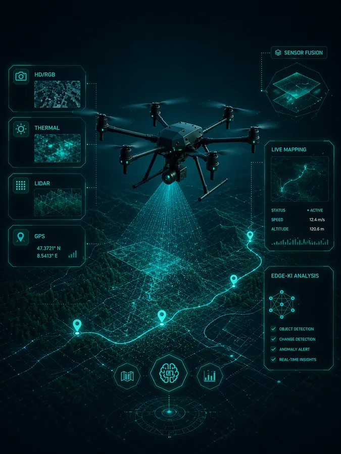
MX Pathfinder — AI-powered UAV intelligence for mapping, sensor fusion and situational awareness.
Find the unseen. Map the unknown. Decide with intelligence.
MX-UAV is a development project by MX Service for edge AI, sensor fusion and automated situation awareness. The platform combines image data, thermal, LiDAR and GPS for reliable results in near real time.
- Live situation awareness from HD and RGB camera data
- Thermal analysis for hotspots and anomalies
- LiDAR for elevation models, point clouds and robust geometry
- GPS and georeferencing for map-ready results